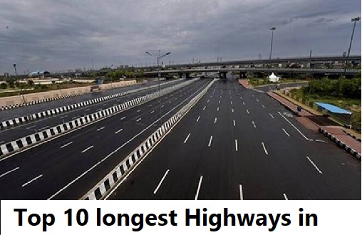
Top 10 Longest Highways in India 2024

National highways or motorways play an important role in the development of the economy of any country. In India, the National Highways Authority of India (NHAI) and the National Highways and Infrastructure Development Corporation Limited (NHIDCL) are the nodal agencies that build and maintain national highways. Luckily, there is a wide network of highways in India that is constantly increasing. A lot of students keep on wondering about questions like which is the longest highway in India? What are the top 5 longest highways in India? etc.
In addition to this, some GK questions in different entrance exams are asked on the various state and national highways in India. If you are also looking to know more about the longest national and state highways in India then this post can help you a lot. Here, we are going to list top 10 longest highways in India in 2024 where NH 44 tops the list.
Top 10 Longest Highway in India 2024
Let’s go through the list of the 10 longest highway in India by distance in kilometers.
1. National Highway 44 or NH 44 – 4,112 km
- Overview – This highway is also known as the lifeline of India. It came into being by merging seven national highways. It connects Jammu and Kashmir in Northern India with Tamil Nadu i.e. the southernmost state of India. The highway starts from Srinagar and terminates at Kanyakumari. Earlier, it was the longest highway in India.
- States Connected – Jammu and Kashmir, Himachal Pradesh, Punjab, Haryana, Uttar Pradesh, Rajasthan, Madhya Pradesh, Maharashtra, Telangana, Andhra Pradesh, Karnataka, Tamil Nadu
- Major Cities Connected – Srinagar, Pathankot, Ambala, Delhi, Faridabad, Mathura, Dholpur, Gwalior, Jhansi, Sagar, Nagpur, Kurnool, Hosur, Madurai, Kanyakumari.
2. National Highway 27 or NH 27 – 3507 Km
- Overview – NH 27 is a part of the famous NS-EW Corridor of NHAI. Leaving behind NH 44, this is now the longest highway in India. It connected western India to eastern parts of India. The highway runs through states including Gujarat, Rajasthan, Madhya Pradesh, Uttar Pradesh, Bihar, West Bengal, and Assam. It originates from Porbandar, Gujarat and ends up in Silchar, Assam. The highway is maintained by the Ministry of Road Transport and Highways (MoRTH)
- States Connected – Gujarat, Rajasthan, Madhya Pradesh, Uttar Pradesh, Bihar, West Bengal and Assam.
- Major Cities Connected – Rajkot, Udaipur, Kota, Shivpuri, Jhansi, Kanpur, Lucknow, Ayodya, Gorakhpur, Darbhanga, Purnia, Siliguri, Guwahati, Silchar.
3. National Highway 48 or NH 48 (Old NH 8) – 2807 Km
- Overview – National highway 48 connected two major metro cities in India i.e. Delhi and Chennai. It is one of the busiest highest in India because it passes through some of the major states and cities. Earlier, this highway was known as NH 8. It was renamed National Highway 48 or NH 48 in the year 2010 when all highways ware renamed.
- States Connected – Delhi, Haryana, Rajasthan, Gujarat, Maharashtra, Karnataka, Tamil Nadu
- Major Cities Connected – Delhi, Gurgaon, Jaipur, Ajmer, Udaipur, Ahmedabad, Vadodara, Valsad, Mumbai, Pune, Kolhapur, Belagavi, Hubli, Bengaluru, Vellore, Kanchipuram, Chennai.
4. National Highway 52 or NH 52 – 2317 Km
- Overview – National highway 52 originates at the junction of National Highway 66 (old number NH 17) at Ankola, Karnataka. It moves up to Arebail ghat of Western ghats and finally reaches the Sangrur Punjab. The highway comes into existence by amalgamating many existing national highways of India.
- States Connected – Punjab, Haryana, Rajasthan, Madhya Pradesh, Maharashtra, Karnataka.
- Major Cities Connected – Hubli, Solapur, Bijapur, Chalisgaon, Dhule, Aurangabad, Beed, Osmanabad, Sangrur, Dewas, Indore, Pithampur, Sendhwa, Shajapur, Shirpur, Jhalawar, Tonk, Hisar, Narwana, Churu, Sikar.
5. National Highway 30 or NH 30 (Old NH 221) – 1,984.3 km
- Overview – National highway 30 originates from the mountains of Sitargunj (Uttarakhand) and terminates at Vijayawada in Andhra Pradesh. The highway runs through multiple remote districts of Uttar Pradesh and Chhattisgarh and is a lifeline for those districts
- States Connected – Uttarakhand, Uttar Pradesh, Madhya Pradesh, Chhattisgarh, Andhra Pradesh, Telangana,
- Major Cities Connected – Sitarganj, Pilibhit, Bareilly, Lucknow, Allahabad, Jabalpur, Raipur, Chintoor, Penuballi, Vijayawada,
Also check: Longest bridges in India
6. National Highway 6 (NH6): 1949 Km
- Overview – National highway 6 connected the northeast states of India. Before renumbering of national highway NH-6 was variously numbered as old national highways 40, 44, 154 & 54. The highway passes through the state of Meghalaya, Assam, and Mizoram. It terminates near Zokhawthar at the Indo-Myanmar border
- States Connected – Assam, Meghalaya, and Mizoram
- Major Cities Connected – Jorbat, Shillong, Kolasib, Aizawl, Champai, and Zokhawthar.
7. National Highway 53 (NH 53) – 1795 Km
- Overview – National Highway 54 connects the state of Gujarat with Odisha. The road is the part of AH46 network in India and it is officially listed as running over Kolkata to Surat. More commonly, this highway is known as the Surat-Kolkata highway. The highway passes through many major cities in Central India.
- States Connected – Gujarat, Maharashtra, Chhattisgarh, and Odisha
- Major Cities Connected – Surat, Jalgaon, Nagpur, Raipur, Deogarh, Paradip Port
8. National Highway 16 (NH 16) (Old NH 5) – 1711 Km
- Overview – National highway 16 is a major highway that runs along the eastern coast of India near the Bay of Bengal. The highway plays a major role in connecting the following states West Bengal, Odisha, Andhra Pradesh and Tamil Nadu. It is a part of much the famed Golden Quadrilateral project undertaken by National Highways Development Project. Many cities are town on the eastern coast of India are connected with this highway.
- States Connected – West Bengal, Odisha, Andhra Pradesh, Tamil Nadu
- Major Cities Connected – Kolkata, Bhubaneshwar, Srikakulam, Visakhapatnam, Vijayawada, Guntur, Nellore, Chennai.
9. National Highway 66 (NH 66) (Old NH 17) – 1640 Km
- Overview – National Highway 66, commonly referred to as NH 66 is a long busy highway that runs through the south-western coast of India. The highway passes through hills, forests, rivers, rivulets, streams, etc. and provides a good landscape for the visitors. It starts at Panvel in Maharashtra and terminates at Kanyakumari
- States Connected – Maharashtra, Goa, Karnataka, Kerala, and Tamil Nadu
- Major Cities Connected – Panvel, Ratnagiri, Panaji, Mangaluru, Udupi, Kochi, Kannur, Thiruvananthapuram, Kanyakumari
10. National Highway 19 (NH 19) (Old NH 20) – 1435 Km
- Overview – The national highway is a road that runs across the Northern and Eastern parts of India. It connects the city of Agra in Uttar Pradesh to Kolkata in West Bengal. This highway constitutes a major portion of the historical Grand Trunk Road. This road is also a part of AH1 of the Asian Highway Network, which traverses from Japan to Turkey.
- States Connected – Uttar Pradesh, Bihar, Jharkhand, West Bengal
- Major Cities Connected – Agra, Kanpur, Prayagraj, Varanasi, Sasaram, Dhanbad, Asansol Durgapur, Burdwan
Frequently Asked Questions
The longest highway in India is National Highway 44.
As per the data of the Ministry of Roads, Transport and Highways (MoRTH), there are around 599 national highways in India.
The shortest national highway in India is National Highway 47 A (NH 47A). The length of this highway is just 5.9 kilometres.
The busiest highway in India is National highway 48 or NH 48. It is so because it connects National capital of India i.e. Delhi with the financial capital of India i.e. Mumbai.


